- Home
- Trails
- Gloucester
- Red Rocks
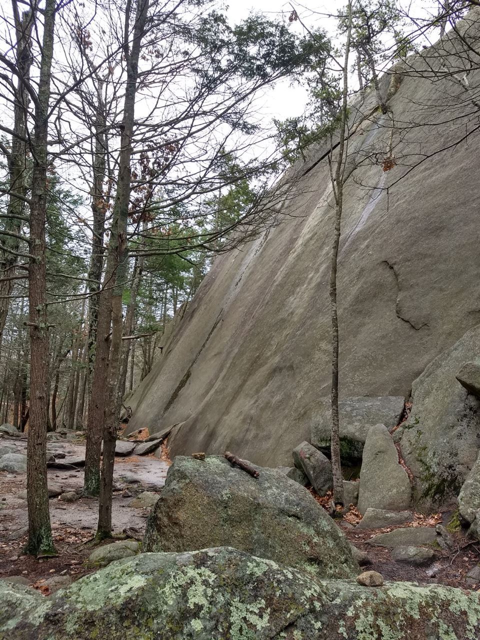
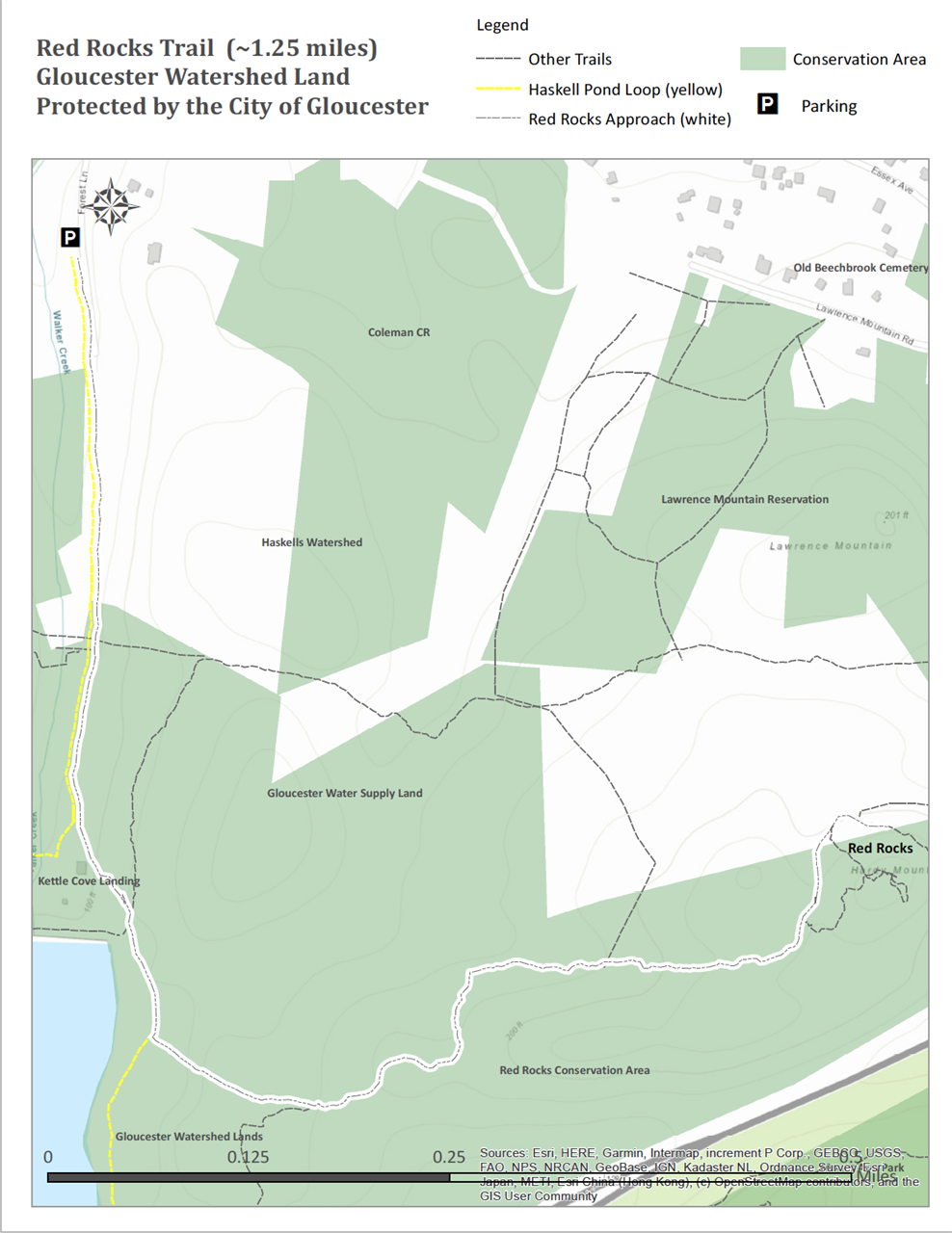
Red Rocks TrailPermanently protected by the City of Gloucester. Trail Difficulty: Moderate to difficult Length: ~1.25 Miles Description: This hike takes you to the base of the Red Rocks climbing area, with a vista point along the way. Directions: Walk to your left from the kiosk and follow the white diamond-shaped markers along the gravel access road to the dam, approximately 4 tenths of a mile. As you approach the dam, look to your left along the edge of the woods for a trail head with white markers. Follow the white markers through a short section of woods, then along an access road, and then left onto a woods road. The woods road becomes a single track trail shortly before the turn off to the vista point on the right. Continue past the vista point along the single track trail to the base of Red Rocks.
| Parking & AccessTo access the Red Rocks trail, park off Forest Lane, just to the north of the reservoir. The parking area is located along Forest Lane in West Gloucester, just off of Route 133. There is enough parking for 8 to 10 vehicles.
|